At Islamorada on the evening of September 2, 1935, the rescue train arrived into the disaster it had been sent to escape. Dispatched from Miami to evacuate relief workers in the Upper Keys, it had been delayed on the journey south. Near the station, hurricane winds shifted and the sea surged across the islands. Cars left the rails. The railroad that had made the Keys seem reachable could not, at the decisive hour, make their inhabitants safe.
That reversal is the central fact of the modern Keys. The Overseas Railroad, built between 1905 and 1912, was an extraordinary achievement, but its achievement was connection, not conquest. When the Labor Day hurricane broke the line, Florida converted much of its surviving infrastructure into a highway. A new transportation system inherited the old geography: islands stretched into open water, their access gathered into a narrow corridor.
It is tempting to tell this as a succession of triumphs, with Henry Flagler's train giving way to the motorist's windshield. The more useful history asks what each triumph required people to forget. Construction demanded dangerous work. The hurricane exposed the vulnerability of men sent to the Keys in search of employment. The highway made ordinary life possible on a much larger scale without abolishing the difficulty of leaving. The bridges are monuments to ingenuity; Islamorada's Hurricane Monument is a necessary correction to what ingenuity alone can promise.
A railroad built by more than one man
Henry Flagler had already extended the Florida East Coast Railway down the peninsula when he undertook the Key West extension. Key West offered a deepwater port and the possibility of expanded trade with Cuba and other markets. The approaching opening of the Panama Canal added another commercial argument. What looks retrospectively like a millionaire's extravagant gesture also belonged to an economic map of ports, shipping routes and railroad connections.
Engineers investigated alternatives before settling on a route through Key Largo and along the island chain. William J. Krome's surveys helped turn the proposal into a line that could actually be built. Construction began in 1905. The engineering problem was not simply to place rails on islands, but to carry them across the gaps between islands, maintaining a continuous railway through a landscape defined by interruption.
The familiar emphasis on Flagler's determination can reduce the workforce to scenery. Thousands of men worked on the project, and hurricanes in 1906, 1909 and 1910 threatened construction. Laborers, engineers, boat crews and the people maintaining the camps made possible the views later celebrated from passenger cars. A bridge can preserve its designer's calculations while erasing the exhaustion of its builders; historical description has to put that work back into the picture.
In January 1912 Flagler arrived in Key West aboard the completed railway. The ceremony supplied an irresistible ending to a construction story. It did not guarantee the railway's commercial future. Freight traffic disappointed expectations, and the extension never became the effortless conduit imagined in its promotion. This distinction matters: a structure can succeed technically while the economic forecast used to justify it proves much less durable.
The veterans were building a different future
By 1935, unemployed World War I veterans were living in federal relief camps in the Upper Keys and working on highway construction. They were not Flagler's original railroad builders. Keeping those groups distinct prevents a common compression of the history, in which everyone who labored near a bridge becomes part of the same heroic enterprise. These men belonged to the Depression, to relief administration and to a new effort to improve road travel.
Their presence made the coming storm a test of public responsibility. Relief work offered employment, but a job on low islands also required a credible plan for shelter or evacuation. The train requested on September 2 represented an attempt to supply that protection late in the day. Its journey was slowed by operational difficulties, obstructions and worsening conditions. By the time it reached Islamorada, the margin for an orderly withdrawal had disappeared.
The hurricane killed hundreds of people, including many veterans and local residents. Published totals differ because bodies were difficult to recover and identify and because accounts did not always define the veteran population in the same way. Precision should not be performed where the historical record remains uneven. The secure conclusion is terrible enough: a major hurricane struck communities and work camps whose occupants could not withstand its surge.
Remembering only the veterans would also narrow the disaster. Families in the Keys lost homes, relatives and the material basis of daily life. Islamorada was devastated. The relief camps made the catastrophe a national controversy, but the storm did not distinguish a federal payroll from an island household. Its history belongs both to the men temporarily assigned there and to the communities that had to remain and rebuild.
A monument beside the traffic
The Florida Keys Memorial, commonly called the Hurricane Monument, was dedicated at Islamorada in November 1937. Its National Register documentation identifies it as a commemorative property; it is also a burial place. The memorial gathers human remains into the same landscape through which motorists now pass. That proximity changes the meaning of the road. This is not merely a route overlooking a historic disaster. It runs beside the people the disaster left behind.
The monument was a New Deal undertaking, a public response to deaths associated in part with a federal relief program. Its existence does not settle questions of responsibility. Instead it makes the obligation to remember visible in stone. Commemoration can soften a controversy into generalized sorrow, but it can also preserve a place where the harder questions remain available: who understood the danger, who could order a departure, and who had the means to leave?
A roadside monument has an unusual audience. Visitors need not have intended a historical encounter; they may simply stop along the highway. That accidental accessibility is one of its strengths. The memorial interrupts the notion that the Keys are a sequence of beautiful distances. It makes a particular place answer for a particular date, and it asks the traveler to hold the pleasures of access together with the memory of a failed evacuation.
There is no need to embellish the scene with invented last words or a falsely exact death toll. The stranded train, the ruined communities and the public memorial already establish the moral scale. The point is not that building in the Keys was inherently wrong. It is that building access created responsibilities extending beyond construction, ticket sales or the completion of a relief-work assignment.
The highway inherited the railroad
The Florida East Coast Railway did not rebuild its Key West extension after the hurricane. The surviving right-of-way and bridges instead became the basis for a continuous Overseas Highway, opened in 1938. Conversion was not simply a matter of painting lane lines over abandoned track. Railroad structures had to accommodate the different width and demands of motor traffic. Yet reusing them gave the new road an immense physical inheritance.
This was a practical recovery from destruction, and it deserves to be understood as such. Florida did not begin again with an empty sea. It adapted an earlier investment to a transportation system whose importance was growing. The highway changed the terms of access: the traveler could arrive by automobile rather than depend on a railway timetable. The islands became connected to the expanding world of American road travel.
At Seven Mile Bridge, the successive systems remain especially legible. The older crossing was built for the railway between 1909 and 1912 and later carried the highway. The modern road bridge opened in 1982. Seen together, old and new are not interchangeable icons. They record different engineering standards, different vehicles and different expectations about how much traffic a chain of islands should accommodate.
Parts of the older structure have acquired another life for walking and cycling. That reuse can make the former transportation corridor feel wonderfully removed from the urgency of traffic. But it also reveals how misleading the singular phrase Seven Mile Bridge can be. There is the historical railway crossing, its highway adaptation, the modern road bridge, and the preserved portions encountered on foot. The view is one landscape containing several generations of decisions.
Connection is not the same as escape
For the Lower Keys, the highway remains the indispensable overland corridor to the mainland. Calling the Keys a place at the end of a single road expresses that dependence, though it should not be mistaken for an exact description of every Upper Keys junction. The important fact is the chain: many communities depend on a sequence of bridges and roadway links, not on a dense network of alternative mainland routes.
Monroe County's evacuation guidance turns that geography into practical instructions. Residents are told to choose a destination, fill vehicles early, take medications and important documents, and evacuate when directed. The county organizes the islands into evacuation zones and provides information about emergency transportation. These are not incidental details appended to island living. They are part of the infrastructure of living there, as necessary in their way as pavement and bridge bearings.
Leaving is not equally simple for everyone. A directive to depart presumes transportation, a destination and the ability to interrupt ordinary obligations. The county's attention to emergency bus pickups and special-needs planning acknowledges that an evacuation cannot be reduced to the decision of an individual motorist. The 1935 story should sharpen that recognition without pretending that today's forecasting and emergency systems are the same as those of the Depression.
Sea-level rise adds a slower pressure. Monroe County reports that high tides already flood streets at certain times of year and that rising seas affect roads and other infrastructure. Its resilience work includes better elevation information and analysis of vulnerable roads. This is a different engineering problem from the spectacular gap between two islands. A bridge may remain high above the channel while access through a neighborhood becomes unreliable.
The enduring question is therefore not whether Florida can build a road over water. That was answered long ago. It is whether the institutions supporting the road can keep pace with the exposure that connection makes possible. A responsible account of the Keys holds the 1912 arrival, the 1935 rescue train, the 1938 highway and today's evacuation instructions in the same frame. The road is a remarkable achievement. Its promise must remain conditional on protecting the people who depend on it.
Sources and photograph
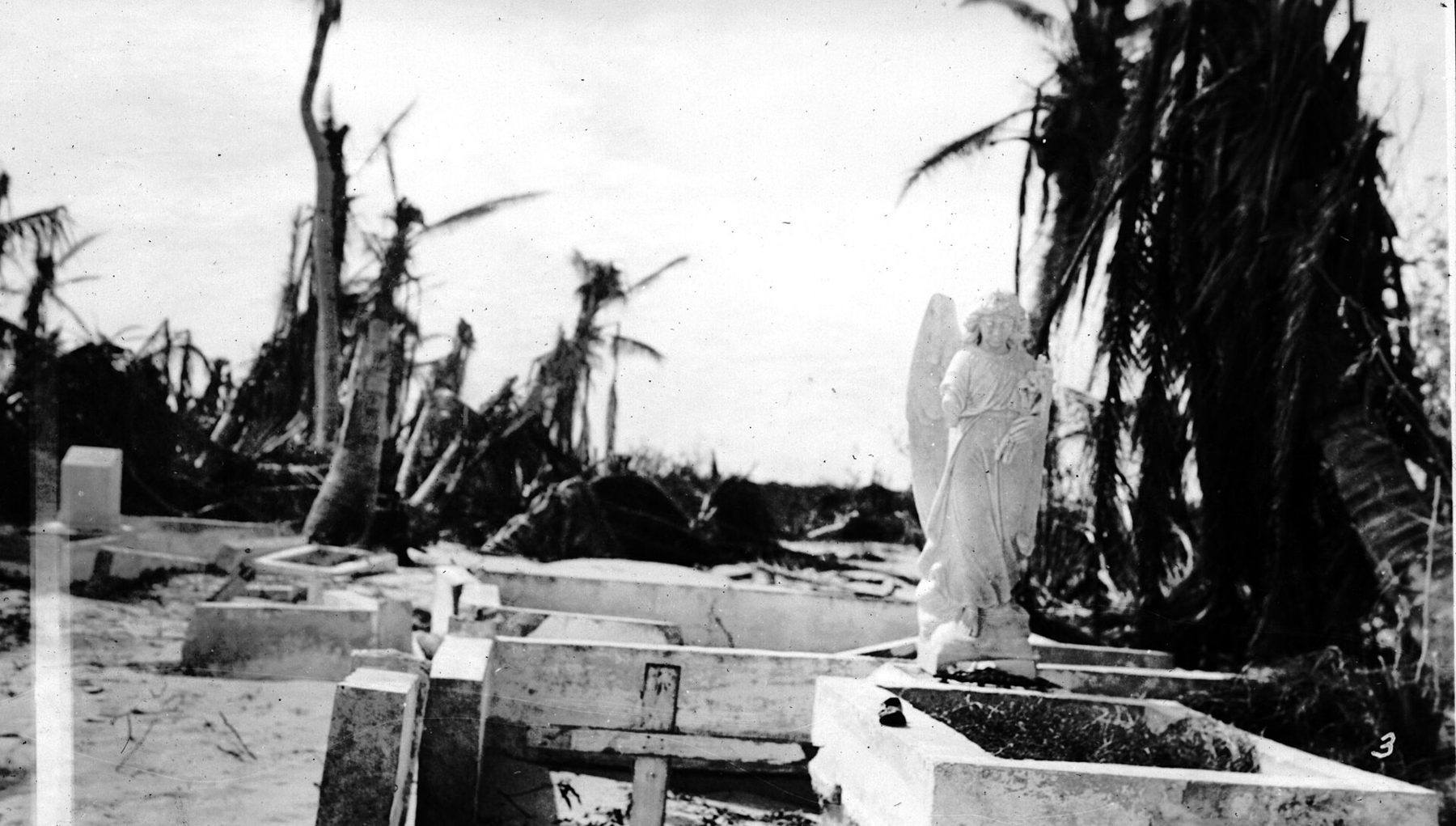
Photograph: Islamorada church after the 1935 Labor Day hurricane, Florida Keys Public Libraries via Wikimedia Commons, CC BY 2.0: commons.wikimedia.org/wiki/File:Islamorada_church_after_the_1935_Labor_Day_hurricane.jpg. This essay draws on the sources listed below. Contested accounts are identified as such in the text.
Questions readers ask
- When was the Overseas Railroad built?
- Construction began in 1905, and the Key West extension opened in 1912. It operated until the 1935 Labor Day hurricane damaged the line.
- Did the 1935 hurricane kill World War I veterans?
- Yes. Veterans employed on Depression-era highway relief work were among the hundreds killed. They should not be confused with the original railroad construction workforce.
- When did the Overseas Highway open?
- The continuous Overseas Highway opened in 1938, reusing much of the former railroad corridor and surviving structures. The railway itself was not rebuilt to Key West.
- Is the Seven Mile Bridge the original railroad bridge?
- There are old and modern crossings. The older structure began as a railroad bridge; the modern vehicular bridge opened in 1982.