In 1928 Florida completed the Tamiami Trail across the southern peninsula. In September, hurricane-driven water from Lake Okeechobee overwhelmed the low barriers along its shore and drowned thousands. One event celebrated the capacity to cross a wet landscape; the other exposed the danger of believing that the landscape had been brought under control. Together they offer a more truthful opening to Everglades history than the familiar contest between wilderness and progress.
The Everglades was never simply a useless swamp waiting for improvement. It was a functioning water system and a human homeland. But for generations of promoters and officials, its value lay chiefly in what could replace it: farms, roads, settlements and taxable property. Drainage was an argument about the future expressed through dredges and canals. It assigned the water a destination and assigned the land a price.
Restoration reverses that judgment without being able simply to reverse time. South Florida now depends on the flood protection and water supplies produced by the same engineering system that damaged its wetlands. The task is not to remove people from the story and let an untouched nature return. It is to redistribute water within an inhabited region, accepting that the river of grass and the communities around it cannot be secured independently.
Making land by moving water
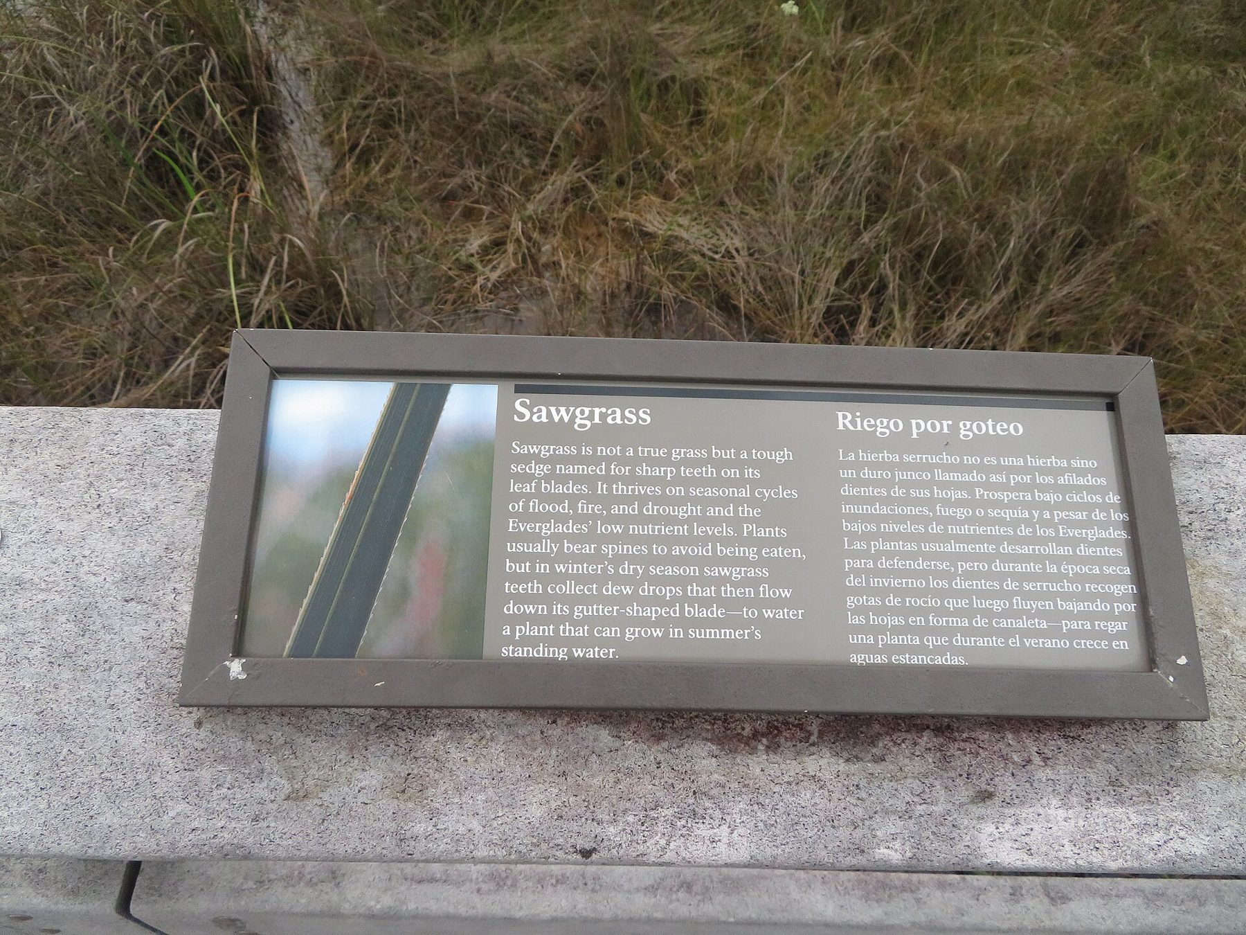
Before drainage, water moved from the Kissimmee basin into Lake Okeechobee and southward across low ground toward coastal estuaries. Sawgrass marshes, sloughs, hammocks and other habitats formed a connected landscape rather than a single uniform swamp. Seasonal movement mattered as much as the presence of water. A wetland could be damaged by receiving too little, too much, or water at the wrong time.
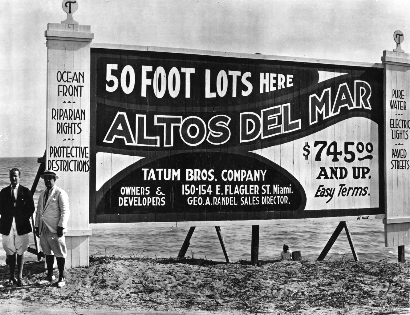
Hamilton Disston entered this landscape as an investor. In 1881 he bought four million acres of Florida land for one million dollars. His drainage ventures sought to lower water levels and open land to agriculture and sale. Canals altered connections among rivers, the lake and the coast, while the scale of his purchase helped publicize Florida as an investment opportunity. The promise of transformation traveled farther than the dredges themselves.
Disston did not successfully drain the whole Everglades. His works encountered rock, limited capacity and the difficulty of managing a wet season rather than a static body of water. That partial failure is more revealing than a neat tale of either conquest or defeat. The engineering could fall short while the economic idea continued to flourish. Land speculation did not have to wait for a complete understanding of the water.
The work also depended on men laboring in difficult and dangerous conditions. Maps of canals make transformation look clean: one line joins another, and a blue area becomes available ground. On the ground, excavation was bodily work. A serious account must keep the labor beside the investment, rather than allowing the purchaser's acreage to stand for everything that happened.
Broward made drainage a public promise
In the 1904 campaign for governor, Napoleon Bonaparte Broward made Everglades drainage a central commitment. Here was a politician presenting reclamation not merely as a private business opportunity but as a program of government. Land that seemed inaccessible could become productive. Engineering would demonstrate the state's capacity to enlarge its own future.
After his election, Broward pursued the program, and the Everglades Drainage District was formed in 1907. Plans, taxes, dredges and land sales translated the campaign into institutions. The process also created incentives to describe unfinished work with excessive confidence. Land could be marketed on the strength of what officials and engineers expected drainage eventually to accomplish.
The National Park Service records expanded dredging between 1905 and 1910 and the conversion of wetland to agricultural land. Railroads increased access, development accelerated, and new residents required still more roads and canals. This was a reinforcing sequence: drainage encouraged settlement, and settlement made further drainage appear necessary. Every investment strengthened the political demand to defend the investments already made.
Calling the earlier landscape a swamp helped make that sequence seem self-evident. The word could obscure a place's existing ecological functions and the people who already knew how to inhabit it. Seminole and Miccosukee histories do not begin when drainage promoters arrived. To describe reclamation as the creation of value from nothing is therefore not just ecologically mistaken. It also grants the developer the authority to decide whose relationship with the land counts as history.
The lake, the hurricane and the wall
The 1928 Okeechobee hurricane made the social terms of reclamation brutally visible. Thousands died when lake water crossed the inadequate levees and inundated nearby settlements. Many of the dead were Black agricultural workers. The fertile ground around the lake had become a place of production, but its workers did not enjoy security commensurate with the value extracted from it.
The racial history is not an optional addition to a meteorological account. It changes what the event means. A hurricane is a physical hazard; the distribution of people, housing, protection and recovery resources determines how that hazard becomes a human catastrophe. To remember only the wind or the failure of an earthen barrier would leave the structure of vulnerability unexplained.
Federal involvement expanded after the disasters of the 1920s. Following Herbert Hoover's inspection of the region, the Army Corps of Engineers developed a larger flood-control scheme. Levees built in the 1930s and later enlargements became the system known as the Herbert Hoover Dike. The lake increasingly became a managed reservoir bounded by protective works rather than a freely fluctuating part of the surrounding wetland.
There were compelling reasons to prevent another mass drowning. Recognizing the ecological consequences does not require dismissing that imperative. It requires acknowledging that a wall protecting one landscape also changes the movement of water into another. The conflict was not between people who understood danger and people who loved scenery. It was between immediate needs for protection and the accumulating consequences of reorganizing a regional system.
The Tamiami Trail belonged to that reorganization too. Opened in 1928, the road connected the coasts while its elevated roadway impeded the movement of water south. Transportation and hydrology were being designed as though they could be separated. Modern efforts to improve flow beneath and through the corridor reveal the cost of that assumption: a road can connect people across a wetland while dividing the wetland itself.
A park and a river of grass
In 1947 two events offered another way to understand the Everglades. Everglades National Park opened, after years of organizing and land acquisition, and Marjory Stoneman Douglas published The Everglades: River of Grass. Ernest Coe and other park advocates had worked for protection well before that year. Douglas did not single-handedly invent conservation, but her book gave the landscape an enduring interpretive form.
River of grass was a powerful corrective to the idea of stagnant waste. It asked readers to understand movement, scale and relationship. A landscape that looked empty from the viewpoint of a prospective subdivider could instead be understood as an intricate system. The change in language mattered because public protection requires a public able to recognize what is being protected.
Yet a park boundary could not supply its own water. In 1948 Congress authorized the Central and Southern Florida Project, the extensive network of canals, levees and control structures that reorganized regional water management. Its purposes included flood protection, water supply, navigation, wildlife protection and water for the park. Those purposes were not automatically compatible, especially as development increased the claims on the system.
The National Park Service acknowledges both sides of that inheritance: the project still supplies intended benefits, while alterations to wetlands, bays and estuaries have severely degraded the natural system. That is the governing contradiction of modern Everglades history. Protection and damage were not always the work of separate institutions. They could emerge from the same project, depending on where one stood and when the water arrived.
The jetport fight moved the boundary
The proposed Big Cypress jetport forced conservationists to confront what a park boundary could not do. The Dade County Port Authority acquired an enormous tract north of Everglades National Park, and construction began in 1968. Plans called for multiple runways and major transportation connections. The airport was not the only issue. The development it would attract threatened to reorganize the surrounding watershed.
A 1969 environmental report by Luna Leopold and collaborators described the danger in regional terms. Drainage and associated growth could damage the South Florida ecosystem and, with it, the national park. Conservationists, hunters and citizen activists opposed the project. Douglas and the newly formed Friends of the Everglades joined the coalition. The fight expanded the meaning of protection from defending a designated tract to defending the processes sustaining it.
The 1970 Everglades Jetport Pact halted the larger scheme. One runway remained, used for aviation training, rather than the vast airport complex originally envisioned. Big Cypress National Preserve followed in 1974. The outcome was neither an untouched landscape nor total development. It was a political limit imposed before one construction project could make a much larger transformation seem inevitable.
That distinction still matters. Environmental victories are sometimes described as though they preserve an earlier world in amber. The jetport fight instead demonstrated that the future could be negotiated. Scientific evidence helped reveal consequences beyond a project's footprint, and a coalition made those consequences politically consequential. Restoration would require the same ability to see beyond the boundaries of an individual undertaking.
Restoration means operating a different system
Congress authorized the Comprehensive Everglades Restoration Plan, or CERP, in 2000. The program seeks to restore, protect and preserve regional water resources while addressing the needs of an inhabited South Florida. Its central concern is not simply adding water to a park. It is improving quantity, quality, timing and distribution across an altered system.
That vocabulary is less romantic than river of grass, but it explains what restoration requires. Water needs places to be stored rather than discharged at damaging times. It needs treatment before reaching sensitive wetlands. It needs routes through barriers and operating rules that make physical connections useful. A reservoir, treatment marsh or bridge is therefore a component, not a synonym for recovery.
The current picture must be dated carefully. The CERP overview consulted for this essay in November 2026 describes restoration as a continuing federal-state undertaking, not a completed rescue. Earlier schedules and initial cost estimates should not be mistaken for present accomplishments. Nor should an announced contract, an excavated canal and an operating reservoir be collapsed into a single ceremonial word: completion.
An accessible National Park Service account of the Tamiami Trail work, dated September 2, 2020, documents a contract for raising and reconstructing the remaining eastern roadway and improving water conveyance. That dated record establishes what was commissioned, not proof that every later restoration objective has been met. It also makes the reversal concrete: public money was being committed to helping water cross a road built as an emblem of progress.
The appropriate test is consequently more demanding than whether construction advances. Does cleaner water reach the places that need it, in the seasons they need it, without transferring unacceptable risks to neighboring communities? South Florida cannot return to the moment before Disston's purchase or Broward's campaign. It can refuse their premise that the wetland becomes valuable only after it is made into something else. Restoration begins by recognizing that the water was already doing work.
Sources and photograph
Photograph: Sawgrass, Pa-hay-okee Trail, Everglades National Park, Florida by Ken Lund via Wikimedia Commons, CC BY-SA 2.0: commons.wikimedia.org/wiki/File:Sawgrass,_Pa-hay-okee_Trail,_Everglades_National_Park,_Florida_(51130668684).jpg. This essay draws on the sources listed below. Contested accounts are identified as such in the text.
Questions readers ask
- Who tried to drain the Everglades?
- Hamilton Disston sponsored major drainage ventures after his 1881 land purchase. Governor Napoleon Bonaparte Broward later made drainage a public program, followed by much larger government water-control projects.
- Why was the Herbert Hoover Dike built?
- Deadly lake flooding in the 1920s prompted expanded federal flood-control works. The dike developed through multiple construction periods rather than appearing all at once.
- When was River of Grass published?
- Marjory Stoneman Douglas published The Everglades: River of Grass in 1947. Everglades National Park also opened that year.
- What is CERP?
- The Comprehensive Everglades Restoration Plan was authorized in 2000. It seeks to improve regional water quantity, quality, timing and distribution rather than simply flooding land indiscriminately.
Sources
- 01Draining and development of the Everglades
- 02National Park Service: Developing the Everglades
- 03National Park Service: Conservation Efforts
- 041928 Okeechobee hurricane
- 05Herbert Hoover Dike: historical development
- 06Everglades National Park: ecology and history
- 07National Park Service: the Big Cypress jetport
- 08Comprehensive Everglades Restoration Plan