This guide uses Big Pine Key as an anchor for understanding the Lower Keys, not as a claim that every place discussed lies on the same island. It is an orientation drawn from public reference accounts, conservation history and official county information, rather than a reporting visit or a wildlife-sighting report. The emphasis is on the relationships among Key deer habitat, Blue Hole, Bahia Honda and Looe Key. These are different environments with different rules and practical requirements; they should not be treated as interchangeable stops in a single park.
Why visit Big Pine Key and the Lower Keys
- 01
Read the landscape through an endemic deer
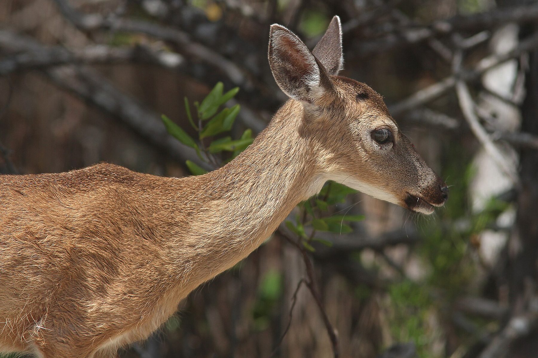
The endangered Key deer is a small subspecies of white-tailed deer native to the Florida Keys. Its presence makes ordinary roads, water sources and patches of habitat part of a conservation story rather than background scenery.
- 02
Look at the quarry as altered habitat
Blue Hole is an abandoned rock quarry containing mostly fresh water. Its later use by wildlife shows how an industrial excavation can become ecologically significant without ceasing to be a human-made feature.
- 03
Follow the railway beyond the main crossing
Bahia Honda’s old railroad bridge belongs to the same transport history that shaped the rest of the Keys. Its relationship to the channel gives that history a different visual character from the long parallel lines at Marathon.
- 04
Distinguish a reef from an island
Looe Key is an offshore coral reef south of Big Pine Key. Understanding that distinction is fundamental to planning: the name does not describe another community that can be reached by continuing along the highway.
History: settlement, infrastructure and a refuge established in 1957
Big Pine Key is an unincorporated community in Monroe County, not a separate incorporated city. The island also lay on the Overseas Railroad route. Its history therefore belongs both to local settlement and to the transport systems that linked distant islands into a continuous corridor. The road is an organizing line, but it is not the full extent of the place.
The National Key Deer Refuge was established in 1957. That date marks a conservation institution created within a landscape already used by people, not the beginning of the deer’s relationship with the islands. The refuge protects more than one kind of habitat and extends beyond the simple image of a fenced enclosure containing a single species.
Bahia Honda’s historic bridge is part of the earlier railway landscape. After the 1935 hurricane ended Overseas Railroad service, the surviving transport works acquired new uses within the highway era. A remnant bridge should be read in that sequence: its present appearance records construction, adaptation and eventual replacement, rather than one frozen moment of engineering ambition.
Culture and people: living alongside protected wildlife
The Key deer is a subspecies of white-tailed deer endemic to the Florida Keys. Its conservation status is endangered. A guide can state those established facts without offering a current population estimate, which requires a dated survey and a clearly defined study area. Apparent familiarity with people should not be confused with domestication or a reason to approach an animal.
Big Pine Key is also a settled community with shops and ordinary services along the highway corridor. Conservation here is consequently not only a matter of visiting land set aside from daily life. It concerns the proximity of human movement, development and wildlife habitat. The useful interpretive question is how those uses coexist, not where a guaranteed deer photograph can be obtained.
The guide’s broader Lower Keys frame is deliberate. Bahia Honda is another island, and Looe Key is offshore; neither should be relocated onto Big Pine Key for narrative convenience. Keeping those distinctions visible respects both the local geography and the different public institutions responsible for land, water and wildlife.
Landscape and water: Blue Hole, Bahia Honda and Looe Key
Blue Hole is an abandoned quarry whose rock was used for nearby road fill and the Overseas Railroad. Its water is described as mostly fresh, and wildlife includes birds, reptiles and Key deer. It belongs to the National Key Deer Refuge landscape. Calling it a quarry lake is more informative than presenting it as an unexplained natural pool.
Bahia Honda State Park occupies most of Bahia Honda Key, east of Big Pine Key along the highway. The island’s name refers to a deep bay, and its western channel helps explain the prominence of the bridge structure. Shoreline recreation and railway remains share the same setting, but a view of an old span is not a promise that every part of it is accessible.
Looe Key is a coral reef south of Big Pine Key within the Florida Keys National Marine Sanctuary. Its setting is marine rather than terrestrial. Published descriptions identify protected zones, including an area reserved for research; consult the sanctuary’s current rules rather than treating an older map or a tour description as a complete statement of permitted activities.
Businesses and working economy: a community, not a wildlife compound
The highway gives Big Pine Key a commercial spine of shops and services, while the wider area’s marine recreation depends on access to surrounding waters. These are different relationships to the landscape. Buying supplies along U.S. 1, visiting refuge land and joining an offshore trip do not involve the same operator or the same form of permission.
Hurricane Irma struck the Lower Keys in September 2017, with its Florida Keys landfall at Cudjoe Key. The storm damaged communities and affected Key deer habitat and animals. That history belongs in a place guide because it demonstrates the vulnerability of both built and ecological systems. It does not establish that a particular business, beach or facility remains damaged today.
Current conditions: wildlife space and official notices
Use Monroe County’s official website, https://www.monroecounty-fl.gov/, for current public notices and local services. Before visiting refuge lands, obtain current guidance from the U.S. Fish and Wildlife Service; consult Florida State Parks for Bahia Honda arrangements and the marine sanctuary for offshore rules. Each authority answers a different question, so a county notice is not a substitute for a park or sanctuary instruction.
Leave wildlife space and do not plan around an assured encounter. Confirm access, programs and marine departures directly with the responsible operator, especially where a plan depends on a bridge segment, shoreline area or offshore destination. The historical record explains why these places matter, but it cannot establish today’s weather, road situation, water quality or available facilities.
Photograph and source record
Photograph: KEY DEER (Odocoileus virginianus clavium) (5-7-14) big pine key, monroe co, fl -02 by Alan Schmierer via Wikimedia Commons, CC0: https://commons.wikimedia.org/wiki/File:KEY_DEER_(Odocoileus_virginianus_clavium)_(5-7-14)_big_pine_key,_monroe_co,_fl_-02_(14200951854).jpg. This guide is an orientation drawn from the public record and the sources listed below, not a reporting visit.
Questions readers ask
- Where can you see Key deer?
- The National Key Deer Refuge protects habitat in the Lower Keys, including Big Pine Key and No Name Key. The animals are wild, so a visit cannot guarantee a sighting and should not depend on close contact.
- What is the Blue Hole on Big Pine Key?
- It is an abandoned rock quarry containing mostly fresh water and used by wildlife. It forms part of the National Key Deer Refuge landscape, rather than being a separate town or an offshore dive site.
- Is Bahia Honda State Park on Big Pine Key?
- No: Bahia Honda State Park is on Bahia Honda Key, east of Big Pine Key. The old railway bridge and surrounding shoreline belong to that separate island setting.
- Can you drive to Looe Key?
- Looe Key is an offshore coral reef, not an inhabited island on U.S. 1. Any proposed visit requires marine arrangements and attention to current sanctuary regulations.
- Did Hurricane Irma affect the Lower Keys?
- Yes: Irma made its Florida Keys landfall at Cudjoe Key in September 2017 and affected nearby communities and wildlife. Historical storm damage should not be used to infer current access or the present condition of a particular site.